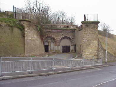
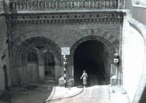
North Entrance
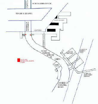
Please click on the map for big copy and pictures inside
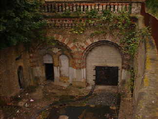
Picture: Kentish Express, April 17th 1964 Picture: Jeff Howe, Feb 13th 1999
Please Click on The Traffic Light !
The images above are of the North Entrance, the one on left the taken by the Kentish Express newspaper in 1964 when traffic had already been banished due to the derelict state of the bridges, the other taken by the author, February 1999.
The North Entrance and Archcliffe Gate were the main security points for traffic travelling into the fortress from North and South Military Roads, respectively.
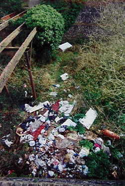
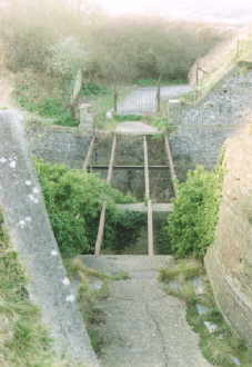
The picture below shows the current state of part of the ditch.

Picture taken February 27 1999 Picture taken September 2000
Is this the best possible use for the area ?
Allegedly the above rubbish is soon to be removed. We'll have to wait and and see !
The North Entrance comprises two bridges running over the ditch separated by a central tenaille or 'island'. The inner bridge was retractable, much like a mediaeval drawbridge. The other side of this is a road tunnel cut through the chalk that comes out inside the fortified Heights.
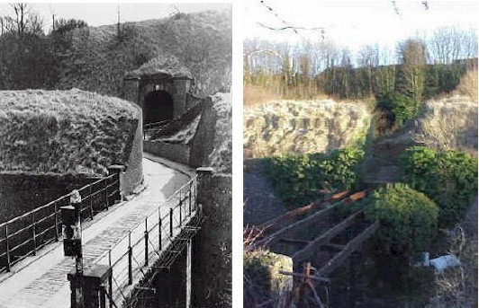
Looking back from the centre tenaille or 'island' across the outer ditch back to North Military Road
The Inner end of the North Entrance
LEFT: By John Peverley, 1950's; RIGHT: September, 2000

The North Lines Ditch where the new road was cut through. This view is from the Drop Redoubt side of the road, looking west